Forgive me....I just love to tell stories.
“Pang
G2 na ang ganda mo!” (Your
beauty is G2-ready already), that’s how it all started.....
 |
| Mt. Guiting-Guiting signage on the way to DENR |
Mt. Guiting-Guiting or commonly known to
Philippine mountaineering community as G2 sits proudly at the island of Sibuyan
in the province of Romblon. ‘Guiting-Guiting’
or ‘Gunting-Gunting’ (tagalog
translation of scissor-like edges) was tagged as the most difficult and most
challenging mountain alongside Mt. Halcon in Oriental Mindoro and Mt.
Mantalingajan in Palawan. The three mountains aforementioned are also known as
“The Knife Edge Trilogy” of Philippine mountaineering.
 |
| The majestic Mt. Guiting-Guiting |
While a lot of people are busy celebrating
Labor Day and some are protesting with how the government was treating the
local employment, I was busy trying to fill up ‘Adra’ (my hiking bag’s name) with all my stuff for the 5-day
itinerary of my very first major climb with 9/9 classification on trail
difficulty. I made a mental note to pack light as much as I could. Given my
actual weight of 116 lbs, carrying a load of more than 10 kilos (for me) would
mean terrible back pains.
Day 0,
May 1. I
arrived at Jam Terminal in Kamuning fifteen minutes before our call time. Our
bus took a lot longer to arrive than expected. We left Kamuning for Batangas
Port around 2:30pm. This trip holds a bunch of first times for me. It was my
first time to see Batangas port, my first to ride a RO-RO (roll-on/roll-off)
vessel, my first to bring a cookset (thanks, Donn!) and my first to do a
Reverse Traverse. Yup!
The sound of those two words clings to my
mind like a sweet music. It’s enticing me to sing along. ‘I’m going to love this climb!’ I silently told myself. The
original plan was to do a traverse but we ended up voting for a reverse
traverse on our way to Romblon.
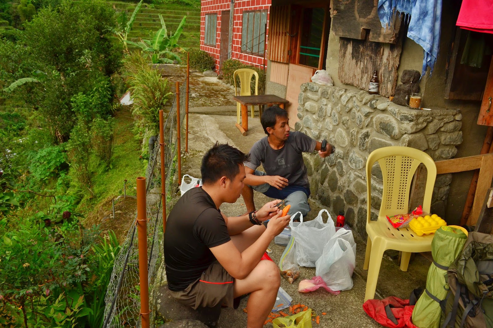
 |
| our crib at Magdiwang, the house of Manong Lee |
Day 1,
May 2. Our
vessel arrived at Port of Romblon at around 4am. Right after filling up the manifesto being
routed by the boat personnel, we took off and head on to buy supplies, withdraw
additional cash (got short on budget.
Thanks, Miko!), had an early heavy breakfast, bought packed lunch while
waiting for our boat ride to Ambulong Port. By 7:30am, we were aboard M/V
Querubin. Two hours after that, we arrived at Ambulong port and made a new
friend by the name of Lisa. She was also to climb G2 that day and we got her to
join us. Our climb consultant, Jepoi has arranged tricycle ride to Manong Lee’s
house but first; we did a 15-minute detour down the market to buy additional
supplies.
 |
| Sir Toto Tansiongco and the blogger |
We were welcomed by Sir Toto Tansiongco, the
eldest son of Manong Lee (R.I.P.) and the President of Mt. Guiting-Guiting
Guides Association of Magdiwang. The house of Manong Lee has been a prominent
rendezvous to mountaineers; veterans and rookies. We did our final preparations
before going to DENR in Brgy. Tampayan, Magdiwang for registration. Via rented
tricycle for P50 each, we reached DENR after 30 minutes. We decided to have our
lunch first before proceeding with the orientation and seminar to be conducted
by the assigned DENR personnel.
 |
| seminar at DENR |
After taking our lunch, we filled up the
Registration Card/Form which includes an Emergency Notification part, sort of a
waiver, I guess. Right after registering our names on the DENR official log
book, we proceeded with the seminar/orientation which took at least 15-20
minutes giving us a short history of Mt. Guiting-Guiting Natural Park. It was declared
a Protected Area and proclaimed as Mt. Guiting-Guiting Natural Park under
Presidential Proclamation No. 746 on February 20, 1996.
At around 1:30pm, we commenced our trek.
This is it!
 |
| getting ready... |
The start of the trail was an open flat
ground for at least 30 minutes until reaching Kaong River (btw, that’s the
river name according to our guide). Here you can view the unobstructed beauty
of G2. This is a very nice place for photo before the gruelling assault to Camp
1 to 3, I must say.
 |
| Kaong River and G2....perfect combination |
Trail to Camp 1 was rolling with small
assaults from time to time. The hard part of it was that the trail is situated in
the middle of the forest so the amount of air passing through is very thin. By
3pm, we reached Camp 1. Another hour and a half were slashed in our time when
we arrived at Camp 2. The trail was becoming steep and I was literally fanning
myself for access to steady air supply. After hitting Camp 2, I took a quick
5-minute rest before proceeding with a more challenging trail to Camp 3. From
here, the famous sharp rocks of G2 were now more visible. Excitement was
starting to build up on me as I stare at those lovely boulders. Time check –
it’s close to 6pm already. We’re losing light faster than expected and the
‘hunky’ Ryan was starting to feel the cramps on his calves. But of course, we
did not let it get in the way....hardcore! J
By 6:40pm, we arrived at Camp 3. It was
already dark when we arrived at the camp. Three tents have already been setup.
‘Damn!’ My tent was with porter and
he’s nowhere near me the entire climb. I was cold, hungry, tired and my tent
was missing in action. To top that, we’re losing space as tents were
continuously being setup. Camp 3 can only accommodate maximum of 8 tents (2P).
While the guides are fetching water at Bulod’s Spring, I was earnestly awaiting
for my tent. After 20 minutes of waiting, came my warm tent....Salvation!!!!!
After fixing my tent, I proceeded with the
most sumptuous meal ever cooked in the history of mountaineering....RICE! Just
rice...’damn hardcore attitude!’ Dinner
was served by 8:30 for me, Ryan, Miko and our guide. By 9pm, I was grinding my
teeth to oblivion.
Day 2,
May 3.
Miko was tapping my shoulder and silently uttering ‘Gising na sila. 4:30 na.’ (They’re awake. It’s already 4:30) It’s
still cold but I have to get up. First thing first, coffee! After cooking
rice...again, we took out the pitched tent and prepare for battle! After a
group photo shoot and a sincere prayer were delivered, we set off for another
round of adventure.
 |
| group pic at Camp 3 taken by the blogger |
We started the trek at around 6:30am. After
15 minutes, we arrived at Bulod’s Spring to get some more water but to no
avail. The drizzle from last night didn’t make enough water to fill up our
bottles. Good thing, I still have at least 2 litres in my hydration bladder.
That should be enough since Mabel’s Spring (next water source) is just three
hours away from Camp 3 in Magdiwang trail. At around 7am, Mayo’s Peak was
waving hello to us! After a quick photo opts with the Mayo’s Peak signage and
the surrounding campsite, we proceeded to the view deck where one could savour
the imposing beauty of ‘Knife Edge’.
It was unbelievably beautiful!
 |
| the fine lady named Lisa. |
 |
| Mayo's Peak |
 |
| the Knife edge and me |
 |
| can't help it! |
After 20 minutes of unending photo opts, we
decided to push through passing ‘Knife Edge’. Contrary to what I believed, the
trail was actually wider than I expected with vegetations in between. The ravine
on both sides, by the way, is a very different thing. The height is as scary as
the sudden change of wind directions. It was infested with leeches ‘limatik’ to which 3 almost bit me.
Leeches here are same with the ones in Mt. Makiling. Luckily, I was armed with
alcohol to wipe them out of my skin. I have never been bitten by any leeches
since the day I started climbing and I’m dreading the day that I would.
 |
| my co-climbers crossing 'Knife Edge' |
 |
| out of focus 'limatik' shot...can you blame me?! |
By 9:04,
we arrived at the ‘Camel Back’. It’s easy to distinguish because it really
resembles the camel’s back. Of course, the trail drastically became steep and
once again, I was panting. After reaching the ‘Camel Back’, we took a quick
rest and did shoot some pictures. The view of ‘Knife Edge’ was of perfect
backdrop in here.
 |
| a sight to behold at Camel's Back |
The trail continues to give us steep assaults
until we reached ‘Kiss the Wall’ at around 9:40am. That portion was not long
contrary to what I presumed and the rocks are very sturdy and nice to grasp in.
It holds on you especially if you’re to do it with bare hands. Yep, I was
climbing the rocks and boulders of G2 with bare hands. It’s much easier for me.
I’m not saying that it would be for others. We arrived at Mabel’s Spring after
15 minutes. The sad part, there was no water to fill up some of my co-climbers
empty bottles.
 |
| Sir Russel and Sir Roderick on our way to Mabel's Spring |
 |
| view at Mabel's Spring |
After
15 minutes of rest, we resume our trek to ‘Peak of Deception’ wherein steeper
and more challenging boulders await us. Here, you can see how technical this
climb is as it requires you to juggle from one boulder to another. You’d feel
like a gymnast in an instant! The boulder trails are easy to find until I came
with this sign.
 |
| see the trail sign?! unbelievable?...believe it! |
After passing the 90 degrees rock, we
reached ‘Peak of Deception’ at 12:05pm. We rested for at least 10 minutes
before continuing with the trek to summit. By 1:08pm, we arrived at ‘Secret
Garden’ just below the summit. I took a video of it since I’m seeing a not so
clear summit. It’s probably better than nothing.
 |
| John Rey, Pao, Miko and Ryan at G2 summit |
Five of us and a guide decided to stay in
the summit hoping for a clearing. Yes, we did have a clearing by 3:30pm. It was
swift but still a good clearing. According to one of my co-climber who lives in
Tablas, the clouds from the summit suddenly decreases starting at 4pm onwards
giving way to a much clearer sky and a perfect view of G2 and its surroundings.
 |
| the blogger at Mt. Guiting-Guiting summit #G2 |
At exactly 4pm, we decided to resume trek before
we ran out of daylight. According to our guide, it would take at least 3-4
hours to Camp 3 of San Fernando trail. With that in mind, we rushed ourselves
down the steep descent passing thru sharp boulders. Most of it was directly
pointed towards us since we’re doing a reverse traverse and the risks of
getting an injury were very high. Some of the small rocks here are also wobbly
making it even harder to balance. With calculated movements and technical manoeuvring,
we continue with our fast pacing ensuring safety for ourselves and for the
climbers in front of us.
 |
| the jagged boulders of G2 |
We reached an open area, (forgot to ask the guide if that is Remvaldy’s
Peak) and this is what my camera captured. Amazing, right?!
We passed the
crash site by 5:30pm wherein you can still see some of parts of the plane.
With
the dusk fast approaching us and the thick forest trail we’re about to get in,
I urged myself to move a notch faster (still
scared of the leeches!). The trail was not only super thick and with lots
of pointed small rocks, it was also steep. There’s a lot of short 90 degrees
descent but upon hearing the voices of our co-climbers, I felt relieved. We
arrived at Camp 3 by 6:35pm. After setting up camp and eating dinner, I decided
to call it a night. By 9pm, I instantly dozed off to dreamland.
 |
| need I say more? taken at the open area I presumed as Remvaldy's Peak |
 |
| at the crash site |
 |
| taken at Bobbit's Peak |
Day 3,
May 4.
Wakeup call was set at 5am. A lot are busy fixing breakfast when I got out of
the tent. Right after breakfast and a little chitchat, we break camp and resume
our trek by 7:55am. The trail going down Camp 2 is what you can classify as ‘bulusok’ (rapid plunge) descent. It was
not intimidating as it sound because as I’ve said, the solid jagged rocks of
G2 was present anywhere you look. Thank
God for that! Some parts are gradual rolling boulders where you can literally swing
yourself from one branch to the other while crossing the sometime shaky ridges.
We reached Camp 2 by 9am and reached Camp 1 two hours after that.
Some took
their early lunch while I contented myself with drinking water. After 15
minutes of rest, we continue our trek to Olango River. Before reaching the
river, we arrived at open flat grassland that one has to wait for the guide.
The trail here is not visible so assistance from the guide is very much
important.
 |
| rest mode at Camp 2 San Fernando trail |
Finally; by 12:30pm, we reached Olango
River.
Due to the hot weather, the river can only give us knee-deep water to
dip in. After eating my lunch and a sponge bath at the river, we resume trek at
1:30pm. The trail was generally flat showcasing orange-colored soil. The scorching
heat of the open trail made all of us walk faster until we reached Sir Remy’s
house by 2:15.
 |
| Olango River in summertime |
 |
| Ryan at the open trail to G2 traverse jumpoff |
‘What
a climb it was!’
That’s all I could think of in between thanking God for the safe climb and
drinking ice cold coke! We made it.
Guiting-Guiting has conquered us heart and soul.
 |
| Sir Remy Rebiso and the blogger |
 |
| I've been conquered by your charm. thank you, Guiting-Guiting! |
For complete details of our itinerary, check
down below!
DAY 0 (May 1, 2014)
12:00 pm Assembly at Jam Terminal Station Kamuning
02:30 pm ETD Kamuning to Batangas Port
04:30 pm ETA Batangas Port / (Tickets secured by Team leader)
05:00 pm ETD Batangas Port to Romblon, Romblon
12:00 pm Assembly at Jam Terminal Station Kamuning
02:30 pm ETD Kamuning to Batangas Port
04:30 pm ETA Batangas Port / (Tickets secured by Team leader)
05:00 pm ETD Batangas Port to Romblon, Romblon
07:00 pm Buy dinner at ferry
09:00 pm Sleep mode
DAY 1 (May 2, 2014)
04:00 am ETA @ Romblon, Romblon
05:00 am Buy Supplies/ Breakfast/ Buy packed lunch
07:30 am ETD Romblon Port to Ambulong Port
09:30 am ETA Ambulong Port (Magdiwang)
09:45 am Rent Tricycle to nearby market (buy additional supplies) then to Manong Lee's House
10:00 am ETA Manong Lee's House
10:30 am Final Preparation
11:15 am Rent Tricycle to DENR (50/head)
11:45 am Lunch @ DENR04:00 am ETA @ Romblon, Romblon
05:00 am Buy Supplies/ Breakfast/ Buy packed lunch
07:30 am ETD Romblon Port to Ambulong Port
09:30 am ETA Ambulong Port (Magdiwang)
09:45 am Rent Tricycle to nearby market (buy additional supplies) then to Manong Lee's House
10:00 am ETA Manong Lee's House
10:30 am Final Preparation
11:15 am Rent Tricycle to DENR (50/head)
12:00 pm @DENR / Seminar / Register
01:30 pm Start Trek
01:30 pm Start Trek
02:00 pm Arrival at Kaong River
(first water source)
03:00 pm Camp 1
04:35 pm Camp 2
06:40 pm Camp 3 / set camp
08:30 pm Dinner
09:00 pm Lights Out
03:00 pm Camp 1
04:35 pm Camp 2
06:40 pm Camp 3 / set camp
08:30 pm Dinner
09:00 pm Lights Out
DAY 2 (May 3, 2014)
04:30 am Wake Up Call/ Preparation for Breakfast / Packed Lunch
05:00 am Breakfast
05:45 am Break Camp
06:30 am Start Trek
07:00 am Photo ops in mayo's peak / Sunrise
07:20 am Begin crossing the 'Knife Edge'
09:04 am ETA ‘Camel Back’
09:40 am Arrival at ‘Kiss the Wall’
09:56 am Arrival at Mabel Spring (no water at the time of climb)
12:05 am ETA Peak of Deception (1959 MASL)
01:08 pm ETA Secret Garden
01:15 am ETA G2
summit (2057 MASL)
01:30 pm Lunch @ summit
04:00 pm Start Descend to San Fernando Trail
01:30 pm Lunch @ summit
04:00 pm Start Descend to San Fernando Trail
05:10 pm ETA Open
View (for confirmation if it’s Remvaldy’s Peak)
05:30 pm ETA Crash
site
06:10 pm Entrance to
thick forest trail (really thick and steep) to Camp 3
06:35 pm ETA Camp 3 / Set up camp
07:00 pm Preparation for Dinner
07:30 pm Dinner
08:00 pm Socials
09:00 pm Light Out
06:35 pm ETA Camp 3 / Set up camp
07:00 pm Preparation for Dinner
07:30 pm Dinner
08:00 pm Socials
09:00 pm Light Out
Day 3 (May 4, 2014)
05:00 am Wake Up call / preparation for breakfast
06:00 am Breakfast
07:00 am Break Camp
07:55 am Start Descend
05:00 am Wake Up call / preparation for breakfast
06:00 am Breakfast
07:00 am Break Camp
07:55 am Start Descend
08:12 am ETA Bobbit’s
Peak
09:10 am @ Camp 2 (End of Outdoor Pilipinas Trail signage)
11:00 am @ Camp 1
12:30 pm ETA Olango River. Lunch.
01:30 pm Resume Trek
02:15 pm @San Fernando Jump off (Sir Remy’s House)/ Soda party!
03:45 pm Take tricycle back to Magdiwang
05:30 pm ETA at Manong Lee’s House
08:00 pm Socials! Celebration time
Day 4 (May 5, 2014)
09:30 am Tricycle
going to Ambulong port
10:15 am ETA Ambulong Port. Secure ticket going to San Agustin Port.
02:30 pm ETA San Agustin Port/ Take Jeep to Odiongan – Top load! (P120/head)
04:30 pm ETA Odiongan, Poctoy Port/ Buy Packed Dinner/ Souvenirs/ Secure ticket to Batangas Pier
05:30 pm ETD Odiongan to Batangas Pier
02:00 am ETA Batangas Pier
04:00 am Home Sweet home
Till then!