With all the planning of my so-called 'Anniversary climb' blasting right in my face and mocking me like a stupid junkie....I never falter. Why would I, when I'm doing my -- birthday climb and the completion of "The Great Cordillera Traverses". As the saying goes... 'good things come to those who wait!'
 |
| Thanks, Shy for this shot! |
Bessie and I luckily made it right under the wire! The culprit....the cake, the traffic and basically US not allotting enough time for travel on a Friday night.
After gearing myself for a cold trip to Banaue, I easily dozed off but of course; hunger is emerging...quickly! We got off to grab something to munch on our first stop in Nueva Vizcaya. Had a little stretching, a little smoke (bad me!) and continued with our journey.
The sun is peaking on my right eye and I was greeted by the calming view of....Banaue! Not to mention the persistent yet happy, accommodating faces of locals offering tour and guide services.
 |
| almost sunrise! |
Right after finishing our breakfast, bought our packed lunch and had my number 2 (you know!), we headed back to register at Banaue Municipal Tourism Center.
The monster jeep were already loaded with our bags and hit the road past 8 in the morning. We arrived in Hungduan an hour after that. Registered ourselves again before going to Mt. Napulawan (Napulauan) jumpoff.
 |
| the ride! |
 |
| at Hungduan Municipal Station |
 |
| groupie at the jumpoff |
 |
| Napulawan (Napulauan) jump off signage |
After all the unloading, packing and securing guides and porters; we were gathered for a small meaningful prayer before hitting the trail.
I was already sweating when I decided to stop 15 minutes later. My heart was pounding as I was gasping for air....damn open trails! Past lunchtime when we reached camp site (not sure if it's Ny-o) and decided to take a rest and eat lunch. After taking some snaps around the area, we continued with the trek as the looming weather approaches.
 |
| view from Hungduan trail |
Note: There's water source five minutes (approx.) of the camp.
 |
| water source after the camp |
The temperature started to drop upon entering the mossy part of the trail. It was a sweet torture while battling the steep ascent. And the rain started to fall while we were assisting our porter's condition (he got a little dehydrated and dizzy). Packed with rain jackets (them) and umbrella (me), we carry on.
A co-hiker said that a sign that you're near the summit camp is the the 5-minute descent followed by a 10-minute assault. Thank you, Supremo! And yes....flat....small flat ground...but still a flat ground! We're at the summit of Mt. Napulauan! Cold and exhausted but we made it!
 |
| a rare moment with Supremo Lester |
The last time I felt this cold was in Pulag. My fingers are numb, my knees are trembling and I'm shaking uncontrollably while Leen and I are setting up the tent in open rain shower! After 5 minutes, we were inside the tent and all I can think of is the wet floor of my tent....Noooo!!!!
First thing to remember to avoid hypothermia, dry yourself up. And that's we did! Right after fixing my sleeping bag, I literally snoozed. When I decided to get up, the weather was more calm. The rain stopped and I can hear my co-hiker asking us for something. I was asking her for a light; on the other hand.
The coffee and spicy pasta that Pao made helped a lot in bringing back a little heat in me. I decided to get up and went to check the cake. The socials area were graced by some of the hikers who braved the chilling night. I asked our event organizer, Jepoi Mansibang of Mansibang Institute if the cake made it to the summit intact. A little bump on the side is all the cake suffered. He passed (with flying colours) the 'Cake Challenge'.
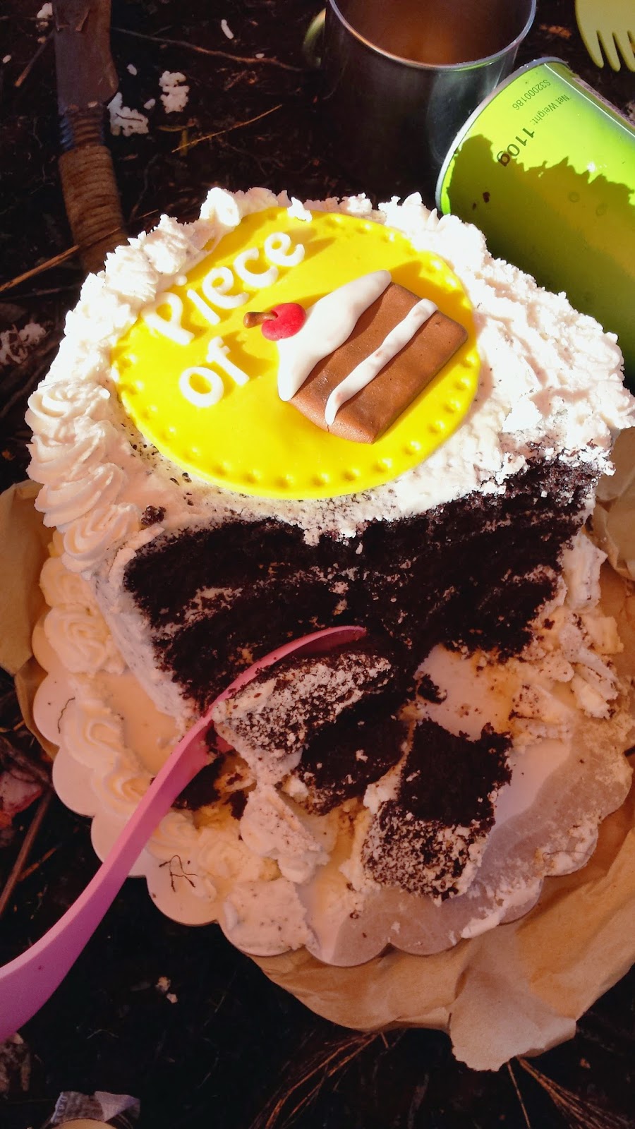 |
| Thank you, Crumbly Yours! |
 |
| with Mannnn, Jepoi Mansibang |
We wrapped up around 10pm. Set up alarm at 5am and bid the night away.
The alarm was hammering my ears....it says 5am. Happy birthday, Redhikerr!
 |
| view from Napulauan summit |
As I open the tent, the cold morning wind greeted me with a freezing slap on my skin and I melted upon seeing the almost lit surroundings of Mt. Napulauan. The beautiful mountain ranges of Cordillera was just that...majestic! Everybody was up and were already taking pictures of the infamous sea of clouds while the sun radiates its beautiful colours.
 |
| have I captured Pulag? |
Breakfast was done by 7am and by 8, we were already geared up for the Hapao trail. If the mossy forest going to summit is superb, wait till you see the Hapao mossy forest. It was enchanting!
 |
| with my co-hikers |
The trail going down were a little steep on the first hour before it gradually shifted to rolling mossy terrains. The impact on leg muscles are less felt since the dried ferns act as a natural cushion while descending.
 |
| the realms of Hapao trail |
 |
| with our hardcore porter |
I thought that this was easier that expected but it all changed when we reached the bamboo area before the rice terraces view deck. The stairs are staring at me. Challenging me. We began the gruelling walk down the stairs to Hapao past 1 in the afternoon and by 2:05 pm, we were at the Hapao Entry point. There, we were welcomed with a hot coffee courtesy of our local guides.
 |
| even our bags looked tired |
While taking turns in the shower, there's this non-stop conversation of each and everyone's adventures and misadventures. After removing my shoes, I then discovered 2 'limatik' bites. Good thing, it wasn't there anymore to scare me!
The monster jeep arrived an hour late of our agreed time. He informed us that there are multiple landslides going to Banaue. Fortunately, none was reported injured during the landslides.
It was quarter to six when we arrived at Banaue. After given instructions by Jepoi of the bus schedule, we hurriedly looked for a quick dinner to fill us up for the long journey back to Manila.
By 7pm, we were aboard the bus bound to Sampaloc, Manila. Tired yet happy. This was another memory worth keeping!
 |
| Group pic at Mt. Napulauan summit |
Below is the quick recap of our itinerary. Note that this was based on my personal recordings.
MT. NAPULAUAN (HUNGDUAN-HAPAO TRAVERSE)
Hungduan, Ifugao
Major jump-offs: Poblacion and Brgy. Hapao, Hungduan
LLA: 16°50′N, 121°10′E, 2642 MASL (#15; 1580m gain)
Hours to summit / Days required: 9 hours / 2-3 days
Specs: Major climb, Difficulty 7/9, Trail class 3
information above courtesy of pinoymountaineer.com
Hungduan, Ifugao
Major jump-offs: Poblacion and Brgy. Hapao, Hungduan
LLA: 16°50′N, 121°10′E, 2642 MASL (#15; 1580m gain)
Hours to summit / Days required: 9 hours / 2-3 days
Specs: Major climb, Difficulty 7/9, Trail class 3
information above courtesy of pinoymountaineer.com
Itinerary:
Day 0 (October 10)
08:00 PM Assembly time in Ohayami Bus Lines (Sampaloc, Manila)
09:11 PM ETD Manila to Banaue
Day 1 (October 11)
03:45 AM Stop over at Bambang, Nueva Vizcaya
07:00 AM ETA Banaue. Arrange bus reservation going back. Take rented jeep to Hungduan, Ifugao
07:10 AM Register at Banaue Municipal Tourism Center.
07:15 AM Breakfast. Buy other needed supplies.
08:07 AM ETD Banaue to Hungduan
09:10 AM ETA Hungduan, Ifugao. Register at Municipal Police Station.
09:45 AM ETA Mt. Napulawan (Napulauan) jumpoff. Load water. Secure guides and prepare for trek.
10:30 AM Start Trek going up the concrete stairs. Turn left. Steep open ascent.
12:30 PM ETA Campsite 1. Rest. Lunch.
01:00 PM Resume trek to Mossy Forest. Water source 5 mins from campsite.
04:55 PM View of the summit descending trail. Lucky us, it was raining hard!
05:15 PM Ascending trail along the ridge.
05:30 PM ETA Mt. Napulauan summit / campsite. Setup camp.
09:00 PM Socials (amidst the chilling night!)
10:00 PM Lights out
Day 2 (October 12-bday ko!)
05:00 AM Wake up call. Team lead prepare for breakfast and packed lunch.
06:00 AM Wait for sunrise. Neverending photo opt.
07:00 AM Break Camp. Prepare for descent.
08:20 AM Start descent to Hapao trail (rolling trail). Amazing mossy forest!
12:10 PM Rest. Lunch.
12:30 PM Bamboo area. Presence of limatik. Got 2!
12:50 PM Start of neverending steep stairs. Open trail.
01:37 PM glimpse of Hapao rice terraces.
02:05 PM End of traverse. ETA Hapao Entry point.
02:15 PM Wash up and coffee. A sweet gesture from our guides/porters.
04:30 PM ETD Hapao to Banaue. Delayed jeep arrival due to landslides.
05:40 PM ETA Banaue. Unload bags. Dinner challenge. Buy souvenirs.
06:30 PM Return to Ohayami Terminal. Load bags to bus. Celebrate.
07:08 PM ETD Banaue to Manila
Day 3 (October 13)
04:10 AM ETA Ohayami (Sampaloc, Manila)
Day 0 (October 10)
08:00 PM Assembly time in Ohayami Bus Lines (Sampaloc, Manila)
09:11 PM ETD Manila to Banaue
Day 1 (October 11)
03:45 AM Stop over at Bambang, Nueva Vizcaya
07:00 AM ETA Banaue. Arrange bus reservation going back. Take rented jeep to Hungduan, Ifugao
07:10 AM Register at Banaue Municipal Tourism Center.
07:15 AM Breakfast. Buy other needed supplies.
08:07 AM ETD Banaue to Hungduan
09:10 AM ETA Hungduan, Ifugao. Register at Municipal Police Station.
09:45 AM ETA Mt. Napulawan (Napulauan) jumpoff. Load water. Secure guides and prepare for trek.
10:30 AM Start Trek going up the concrete stairs. Turn left. Steep open ascent.
12:30 PM ETA Campsite 1. Rest. Lunch.
01:00 PM Resume trek to Mossy Forest. Water source 5 mins from campsite.
04:55 PM View of the summit descending trail. Lucky us, it was raining hard!
05:15 PM Ascending trail along the ridge.
05:30 PM ETA Mt. Napulauan summit / campsite. Setup camp.
09:00 PM Socials (amidst the chilling night!)
10:00 PM Lights out
Day 2 (October 12-bday ko!)
05:00 AM Wake up call. Team lead prepare for breakfast and packed lunch.
06:00 AM Wait for sunrise. Neverending photo opt.
07:00 AM Break Camp. Prepare for descent.
08:20 AM Start descent to Hapao trail (rolling trail). Amazing mossy forest!
12:10 PM Rest. Lunch.
12:30 PM Bamboo area. Presence of limatik. Got 2!
12:50 PM Start of neverending steep stairs. Open trail.
01:37 PM glimpse of Hapao rice terraces.
02:05 PM End of traverse. ETA Hapao Entry point.
02:15 PM Wash up and coffee. A sweet gesture from our guides/porters.
04:30 PM ETD Hapao to Banaue. Delayed jeep arrival due to landslides.
05:40 PM ETA Banaue. Unload bags. Dinner challenge. Buy souvenirs.
06:30 PM Return to Ohayami Terminal. Load bags to bus. Celebrate.
07:08 PM ETD Banaue to Manila
Day 3 (October 13)
04:10 AM ETA Ohayami (Sampaloc, Manila)
04:45 AM Home!
Till then.


