Tuesday, November 11, 2014

Culture and Nature - Mt. Dulang-dulang and Mt. Kitanglad Climb (Part 2)

continuation....

Since we decided to cancel our Kalatungan climb, wake up call at 5 in the morning was perfect enough to regain loss strength and savor a "rain-free" night at the campsite.
the view upon opening my tent door
prepping for breakfast
Break camp came right after breakfast and lunch were packed.
my newly cleaned tent
Break camp with Airis and Jason
break camp almost done...
By 7 AM, the group started trek to Mt. Dulang-dulang summit.
perfect view at the campsite. Thanks for finding this, Sir Jala.


Beauty overload!
After less than an hour emerged a beautiful view of neighboring peaks of Kitanglad Mountain Range.
Helmitchy posing before the summit
Summit....finally! Mt. Dulang-dulang summit was boasting with unspeakable beauty.
sorry NO K (Kalatungan) :(
The group had their fair share of the summit when we decided to continue our trek. The time was past 8 AM.
Happy faces of me, Helmitchy and Racky at D2 summit
Traversing Mt. Kitanglad was one of my most loved part. The trail was steep and the mossy grounds made it a lot easier. It was like going back to Mt. Arayat minus the mossy part. Word of advise: Strengthen up your upper body! :)
Mt. Kitanglad as viewed from summit of Mt. Dulang-dulang
The very steep descent! Upper limb exercise to the max!
It was part 8:30 AM when we reached the first of two rope segments. A good 15-20 feet of rock and mud combined.
I call it 'The drop!'
Ten minutes before 9 when we reached a small view deck showcasing the peak of Mt. Kitanglad and the ridge that we have to pass to get there. Suddenly I was reminded of a song 'so close and still so far!'
the group at the view deck
The ridge and Mt. Kitanglad summit as seen from the view deck
We proceeded with the trek after 10 minutes of rest. We decided to have our brunch along the trail upon the first sight of a flat ground. Sadly, it wasn't only us eating but the enormous amount of huge and hungry mosquitoes as well. They were all over our faces! Some even tried getting through our eyes! With that, we quickly ate our brunch and continued with the trek.
The gang having our brunch...with the mosquitoes!
a not-so clear view :(
At around 11:45 AM, we reached the limatik (leech) infested cogon grass area. This is it...the scary part!
at the entrance of 'limatik' land!
The cogon grasses were tall and covering most part of the trail making it harder to maneuver. Fortunately for us, no limatik were present at that time. Must be because not a single drop of rain ever passed by. The trail was a bit dry based on the mossy patches that I checked. The cogon grass are not that sharp as well and the grounds are of soft mud. Thank God for the ritual! :)
Yep...that's a trail!
After an hour, we reached the last steep ascent (last rope segments). A 15-20 minutes, 80-85 degrees of pure assault holding on to crevices of rocks and grabbing patches of grass and sturdy roots. On a rainy season this could get nasty but since the sun were beaming brightly,
start of the 80-85 degrees assault. happy for the good weather!
I still managed to throw some shots and a selfie...of course.
selfie....finally!
Sir Jalaman in action at the assault part
Past 1 PM when we arrived at the rolling terrain to the bunker houses at the summit. Passing onto some mossy trails and bonsai trees along the way. After 20 minutes, we saw the tip of the bunker houses and some makeshift booby traps made of wires and empty glass bottles.
bunker house...finally!
inside the bunker house with Bea and Yvonne.
 At 1:27 PM, we were at Mt. Kitanglad's summit! It was foggy and the telecommunication towers surrounding the summit was too depressing but still a co-climber managed to give me this nice shot. Thanks, Airis!
Summit shot with Redhikerr
When life gives you lemons, make lemonade. In climbing, when summit gives you fog, make sea of clouds! Haha!

We stayed at the summit for almost an hour snapping shots,  refilling water, doing #2 (poopies) and taking pictures of the bunker beds.
these bunker beds must be heaven!
By 2:20 PM, we were hitting the trail again for our descent to Kitanglad jumpoff. 
Strawberries at the trail down the summit
The trail was not that steep. Presence of steel staircases and tree branches lined with rocks made it a lot easier to go down. Just be mindful of some cable wires as posts were also present.
nice steps along the way
steel staircases for easy descent
It was exactly 5 PM when I arrived at the Mt. Kitanglad billboard/signage.
Done at last! Thanks, Peaks N Prints!
my ever dependable companion... cheers to us!

Here's the detailed itinerary based on my personal account.

Day 0 (Oct 29, Wednesday)
1045 ETD Manila - Cagayan de Oro
1155 ETA Laguindingan Airport, CDO
1220 Meet up with Tatay Bullecer - forgot to ask his first name :)
1235 Lunch at nearby carinderia
1250 Resume travel to Malaybalay
1420 Arrival at "Pagbantay" signage (sort of ritual to all passengers)
1422 ETA Bukidnon
1600 ETA Malaybalay
1618 ETA Provincial Environment and Natural Resources (PENRO)
1720 ETA Talaandig Anestral Territory, Brgy. Sungco
1900 Stay for the night at Hall of Peace
2130 Meet and Orientation with Datu Migketay (study IPRA)
2300 Lights out

Day 1 (Oct 30, Thursday)
0500 Wake up call
0600 Start of Permission Ritual
0800 Start of Cleansing Ritual at a nearby river
0848 Start of Communion Ritual
0920 Photo opt after tribe ritual
0926 Breakfast
1000 ETD Hall of Peace to Mt. Dulang-dulang jump off
1025 ETA Mt. Dulang-dulang jump off. Binahon Agroforestry Farm signage. Start trek.
1145 ETA Mt. Kitanglad Range Natural Park billboard.
1202 ETA Forest Line. Turn left at fork. (almost got lost :( )
1220 ETA Big Tree. Photo opt. Start of mossy forest. Assault trail.
1400 Late lunch near water source
1425 ETA water source. Refill.
1430 ETA Ancestral Domain area signage
1700 Rolling terrain to Mt. Dulang-dulang campsite
1725 ETA campsite. Pitch tent. Prepare dinner.
1930 Socials
2200 Lights out

Day 2 (Oct 31, Friday)
0500 Wake up call
0530 Prepare breakfast and lunch
0630 Break camp. Photo opt. Prepare for summit assault.
0700 Pray. Start summit assault.
0745 ETA Mt. Dulang-dulang summit. Photo opt.
0810 ETD Mt. Dulang-dulang summit traverse to Mt. Kitanglad. Steep descent.
0835 ETA Rope segment
0850 ETA View deck
1000 Brunch along the trail. Mosquito overload!
1030 Resume trek
1145 ETA cogon grass area. Steep ascent to Mt. Kitanglad.
1248 Start of 80-85 degrees assault (15-20 minutes). May require ropes on rainy season.
1307 Rolling terrain to summit
1327 ETA Mt. Kitanglad summit
1330 Refill water at bunker house. Photo opt.
1420 Start descent.
1700 ETA Mt. Kitanglad billboard/jumpoff
1830 Start rough road trek to jeep service
2200 ETA Malaybalay

SPECIAL THANKS to the following:

Bullecer Family - for ALL the assistance (from logistics to ritual needs and FREE biko, corn and rice! Helmitchy, Tatay and Nanay --- Daghang salamat!)

Ka Gerald Ternola - for the invite! Truly what you do as an event organizer is such a pain in the @ss! Salute to you and all the event organizer I have come to meet.

Sir Jalaman - yo da man! Greatly appreciate your "built-in refrigerator."

To our guide and porters, you have my respect and sincerest thanks!

To Datu Migketay, thank you for the learnings! I am truly humbled.

Lastly, to all the participants....Revenge Climb next year!

Till then!


Sunday, November 9, 2014

Culture and Nature - Mt. Dulang-dulang and Mt. Kitanglad Climb (Part 1)

Mt. Dulang-dulang (2,938+ MASL)
Lantapan, Bukidnon
Major jump-off: Sitio Bol-ogan, Brgy. Sungco
Hours to summit: 10 hours (est.)
Specs (Traverse): Major climb, 8/9 difficulty under trail class 2-4 with rope segments
Mt. Dulang-dulang (viewed from the trail of Mt. Kitanglad)
Mt. Kitanglad (2,899+ MASL)
Impasug-ong, Bukidnon
Major jump-off: Sitio Intavas, La Fortuna
Hours to summit (from Dulang-dulang summit): 6 hours (est.)
Specs: Major climb, 6/9 difficulty under trail class 2-4
Mt. Kitanglad (viewed from the summit of Mt. Dulang-dulang)
Every time I see this information on the net, I questioned myself....here we go again but that vanished instantly to oblivion when I think of climbing the 2nd and 4th highest mountain in the Philippines.
My new baby, Omo!
Little did we know that we'll be in for one of the biggest eye opener we'd ever encounter as a mountaineer.

October 29. It was nearing afternoon when we set foot at Laguindingan airport in Cagayan de Oro. We hurriedly made our way to meet our co-climber's dad which will be our 'pro bono' driver in our 'pro bono' ride.
Our 'Ride' while waiting outside DENR PENRO
Road construction going to Malaybalay. Plan your itinerary well! 
After a quick lunch at a nearby carinderia, we continued with our long-drive trip to Malaybalay. From there we met with three more climbers who tirelessly bought and picked up our permit and stuff for the ritual. Yes....there is a ritual!
Team D2K

The "Pagbantay" signage where one has to get off their ride and...
...walk this small board (a cleansing ritual, I guess)
We arrived at Talaandig Ancestral Territory in Brgy. Sungco past five in the evening. Then, we headed straight to the covered stage beside Hall of Peace where we are graciously welcomed by locals who were present at that time. Mitchel, her mom and dad looked out for the chieftain which will be doing the ritual before our climb.
Night falls upon our arrival at Brgy. Sungco
at the Talaandig Ancestral Territory in Brgy. Sungco
It was past nine in the evening when we are summoned by Datu Migketay inside Hall of Peace together with other tribe folks. This for me, is the highlight of our 5-day adventure in Bukidnon and CDO.

The words of the strict yet gentle Datu Migketay still linger vividly in my mind and in my heart. PRE, PRIOR, INFORM, CONSENT and I.P.R.A. Most climbers would say...'What the eff!' It was the same thought running in my sleepy mind while we're given the orientation of what IPRA is all about. It is indeed an eye opener. Not just for me but for all of us. The Kitanglad Mountain Range ('kita' meaning visible and 'tanglad' meaning lemongrass), a native title from the Talaandig tribe of which the legend of a great flood saved forefathers of the tribe is considered 'sacred' thus requiring ritual from all walks of life who would one day destined themselves to climb the famous peaks of Mt. Dulang-dulang, Mt. Kitanglad, Mt. Maagnaw and Mt. Kalatungan to name a few.
Datu Migketay performing the last part of ritual.
IPRA Law also known as Indigenous Peoples Rights Act of 1997 was the first question that Datu Migketay asked us. We were all dumbfounded! None of the 11 climbers at that time knew of IPRA Law. That that law for one, "Shall protect the rights of ICCs/ IPs (Indigenous Cultural Communities/Indigenous Peoples) to their ancestral domains to ensure their economic, social and cultural well being and shall recognize the applicability of customary laws governing property rights or relations in determining the ownership and extent of ancestral domain."
Datu Kinulintang Hall fronting Hall of Peace
The Kinship Covenant.
While we're done with the 'PRE, PRIOR and INFORM' part based on our permit with DENR PENRO (Provincial Environment and Natural Resources), we still lack the 'CONSENT' part. With that, we were asked to introduced ourselves. The discussion went on until past 10:30 in the evening (yup! it's that long and scary <because of the gecko inside the hall> and very informative). Yes, the 'CONSENT' was given to us but the ritual will not be due until sunrise the next day. :(
The Hall of Peace
October 30. Our day started early at six for the ritual (Permission, Cleansing and Communion). The 'Permission' part is where you'll give the following stuff to the tribal leader and ritualist; red cloth, white cloth, 1 peso coins, fighter wine, soda, assorted candies, a pack of cigarette and 5 white chicken.
Symbolic stuff used for the ritual

By 8AM, we headed straight to the nearby river for the 'Cleansing' part of the ritual. Note: The 'ritualist' determines whether the group should do a full submerging of body to the river. Lucky us, we were just asked to wash our hands, feet and face.
the group with the ritualist performing the 'Cleansing' ritual
After less than an hour, came the 'Communion' part of the ritual wherein the chickens were served and final blessing from the tribe leaders. Of course, you know what next to that! Breakfast and....photo opt!
Team D2K with the Talaandig tribe leaders
Past 10 in the morning when we hailed a monster jeep to get us to Dulang-dulang jump-off. Landmark to jump-off is the Binahon Agroforestry Farm signage to the right.

At Dulang-dulang jump-off
We started trek by 10:25 AM and reached the billboard of Mt. Kitanglad Range Natural Park 15 minutes before 12 noon.
The billboard marking our arrival at the Mt. Kitanglad Range Natural Park 
Beautiful contrast of mud and greens
Another 15-20 minutes and you'll reached the forest line. Turn left at the fork.
The start of forest line showcasing Dulang-dulang's beauty.
After 10 minutes of grassy trail, patches of moss started to appear until we reached this famous tree. You know the drill....photo opt! :)
Yours truly :)
After a 10-minute rest, we continued with the mossy trail assault.
From this...
...to THIS!
At around 2 PM, the group had our lunch near the water source. Before 2:30, we reached the water source and refilled our bottles and water reservoir.
Water source at Dulang-dulang
As we gain elevation, temperature dropped...fast! Time is of the essence as the sky above us is starting to show its orange hues between the mossy branches. Tick tock! Tick tock!
'Blue' berries along the trail...first time for me.
The rolling mossy terrain signals the last 15-25 minutes to campsite. We reached the campsite by 5:25 PM and it was dark and really cold! Pitching the tent in less than 8 minutes was next to magic for me. At 6 PM, I was all warm and hungry!
Captured with my phone... you be the judge.
Nearing campsite
We had our dinner by 7PM alongside a soothing cup of hot 3-in-1 white coffee! What a better way to cap the day off....but wait! We still need to plan the next day itinerary. Based on our original plan, we'll be doing the D2KK climb (Dulang-dulang, Kitanglad and Kalatungan). After assessing our current situation (flight back home; mainly) and coordinating with the 'Kalatungan Team' (group of 4), we decided to ditch our Kalatungan climb. :( BTW, a 'Revenge Climb' is boiling hot at this very moment.. Sweeeetttt!!!

Part 2 coming up!

Till then!

Monday, October 20, 2014

Mt. Napulauan Traverse - Birthday Climb

With all the planning of my so-called 'Anniversary climb' blasting right in my face and mocking me like a stupid junkie....I never falter. Why would I, when I'm doing my -- birthday climb and the completion of "The Great Cordillera Traverses". As the saying goes... 'good things come to those who wait!' 
Thanks, Shy for this shot!
Bessie and I luckily made it right under the wire! The culprit....the cake, the traffic and basically US not allotting enough time for travel on a Friday night.

After gearing myself for a cold trip to Banaue, I easily dozed off but of course; hunger is emerging...quickly! We got off to grab something to munch on our first stop in Nueva Vizcaya. Had a little stretching, a little smoke (bad me!) and continued with our journey.

The sun is peaking on my right eye and I was greeted by the calming view of....Banaue! Not to mention the persistent yet happy, accommodating faces of locals offering tour and guide services.
almost sunrise!
Right after finishing our breakfast, bought our packed lunch and had my number 2 (you know!), we headed back to register at Banaue Municipal Tourism Center.

The monster jeep were already loaded with our bags and hit the road past 8 in the morning. We arrived in Hungduan an hour after that. Registered ourselves again before going to Mt. Napulawan (Napulauan) jumpoff.
the ride!
at Hungduan Municipal Station
groupie at the jumpoff
Napulawan (Napulauan) jump off signage
After all the unloading, packing and securing guides and porters; we were gathered for a small meaningful prayer before hitting the trail.

I was already sweating when I decided to stop 15 minutes later. My heart was pounding as I was gasping for air....damn open trails! Past lunchtime when we reached camp site (not sure if it's Ny-o) and decided to take a rest and eat lunch. After taking some snaps around the area, we continued with the trek as the looming weather approaches.
view from Hungduan trail
Note: There's water source five minutes (approx.) of the camp.
water source after the camp
The temperature started to drop upon entering the mossy part of the trail. It was a sweet torture while battling the steep ascent. And the rain started to fall while we were assisting our porter's condition (he got a little dehydrated and dizzy). Packed with rain jackets (them) and umbrella (me), we carry on.

A co-hiker said that a sign that you're near the summit camp is the the 5-minute descent followed by a 10-minute assault. Thank you, Supremo! And yes....flat....small flat ground...but still a flat ground! We're at the summit of Mt. Napulauan! Cold and exhausted but we made it!
a rare moment with Supremo Lester
The last time I felt this cold was in Pulag. My fingers are numb, my knees are trembling and I'm shaking uncontrollably while Leen and I are setting up the tent in open rain shower! After 5 minutes, we were inside the tent and all I can think of is the wet floor of my tent....Noooo!!!!

First thing to remember to avoid hypothermia, dry yourself up. And that's we did! Right after fixing my sleeping bag, I literally snoozed. When I decided to get up, the weather was more calm. The rain stopped and I can hear my co-hiker asking us for something. I was asking her for a light; on the other hand. 

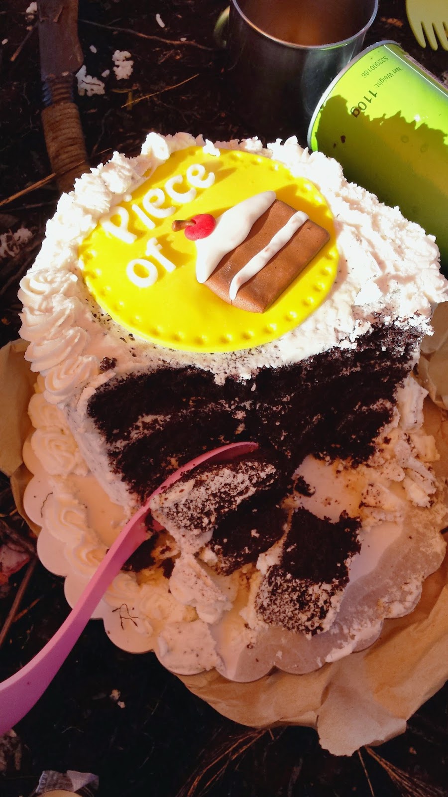
The coffee and spicy pasta that Pao made helped a lot in bringing back a little heat in me. I decided to get up and went to check the cake. The socials area were graced by some of the hikers who braved the chilling night. I asked our event organizer, Jepoi Mansibang of Mansibang Institute if the cake made it to the summit intact. A little bump on the side is all the cake suffered. He passed (with flying colours) the 'Cake Challenge'.
Thank you, Crumbly Yours!

with Mannnn, Jepoi Mansibang
We wrapped up around 10pm. Set up alarm at 5am and bid the night away. 

The alarm was hammering my ears....it says 5am. Happy birthday, Redhikerr! 
view from Napulauan summit
As I open the tent, the cold morning wind greeted me with a freezing slap on my skin and I melted upon seeing the almost lit surroundings of Mt. Napulauan. The beautiful mountain ranges of Cordillera was just that...majestic! Everybody was up and were already taking pictures of the infamous sea of clouds while the sun radiates its beautiful colours.
have I captured Pulag?
Breakfast was done by 7am and by 8, we were already geared up for the Hapao trail. If the mossy forest going to summit is superb, wait till you see the Hapao mossy forest. It was enchanting!
with my co-hikers
The trail going down were a little steep on the first hour before it gradually shifted to rolling mossy terrains. The impact on leg muscles are less felt since the dried ferns act as a natural cushion while descending.
the realms of Hapao trail
with our hardcore porter
I thought that this was easier that expected but it all changed when we reached the bamboo area before the rice terraces view deck. The stairs are staring at me. Challenging me. We began the gruelling walk down the stairs to Hapao past 1 in the afternoon and by 2:05 pm, we were at the Hapao Entry point. There, we were welcomed with a hot coffee courtesy of our local guides.
even our bags looked tired
While taking turns in the shower, there's this non-stop conversation of each and everyone's adventures and misadventures. After removing my shoes, I then discovered 2 'limatik' bites. Good thing, it wasn't there anymore to scare me!

The monster jeep arrived an hour late of  our agreed time. He informed us that there are multiple landslides going to Banaue. Fortunately, none was reported injured during the landslides.

It was quarter to six when we arrived at Banaue. After given instructions by Jepoi of the bus schedule, we hurriedly looked for a quick dinner to fill us up for the long journey back to Manila.

By 7pm, we were aboard the bus bound to Sampaloc, Manila. Tired yet happy. This was another memory worth keeping!
Group pic at Mt. Napulauan summit
Below is the quick recap of our itinerary. Note that this was based on my personal recordings.

MT. NAPULAUAN (HUNGDUAN-HAPAO TRAVERSE)
Hungduan, Ifugao
Major jump-offs: Poblacion and Brgy. Hapao, Hungduan
LLA: 16°50′N, 121°10′E, 2642 MASL (#15; 1580m gain)
Hours to summit / Days required: 9 hours / 2-3 days
Specs: Major climb, Difficulty 7/9, Trail class 3
information above courtesy of pinoymountaineer.com

Itinerary:
Day 0 (October 10)
08:00 PM Assembly time in Ohayami Bus Lines (Sampaloc, Manila)
09:11 PM ETD Manila to Banaue

Day 1 (October 11)
03:45 AM Stop over at Bambang, Nueva Vizcaya
07:00 AM ETA Banaue. Arrange bus reservation going back. Take rented jeep to Hungduan, Ifugao
07:10 AM Register at Banaue Municipal Tourism Center.
07:15 AM Breakfast. Buy other needed supplies.
08:07 AM ETD Banaue to Hungduan
09:10 AM ETA Hungduan, Ifugao. Register at Municipal Police Station.
09:45 AM ETA Mt. Napulawan (Napulauan) jumpoff. Load water. Secure guides and prepare for trek.
10:30 AM Start Trek going up the concrete stairs. Turn left. Steep open ascent.
12:30 PM ETA Campsite 1. Rest. Lunch.
01:00 PM Resume trek to Mossy Forest. Water source 5 mins from campsite.
04:55 PM View of the summit descending trail. Lucky us, it was raining hard!
05:15 PM Ascending trail along the ridge.
05:30 PM ETA Mt. Napulauan summit / campsite. Setup camp.
09:00 PM Socials (amidst the chilling night!)
10:00 PM Lights out 

Day 2 (October 12-bday ko!)
05:00 AM Wake up call. Team lead prepare for breakfast and packed lunch.
06:00 AM Wait for sunrise. Neverending photo opt.
07:00 AM Break Camp. Prepare for descent.
08:20 AM Start descent to Hapao trail (rolling trail). Amazing mossy forest!
12:10 PM Rest. Lunch.
12:30 PM Bamboo area. Presence of limatik. Got 2!
12:50 PM Start of neverending steep stairs. Open trail.
01:37 PM glimpse of Hapao rice terraces.
02:05 PM End of traverse. ETA Hapao Entry point.
02:15 PM Wash up and coffee. A sweet gesture from our guides/porters.
04:30 PM ETD Hapao to Banaue. Delayed jeep arrival due to landslides.
05:40 PM ETA Banaue. Unload bags. Dinner challenge. Buy souvenirs.
06:30 PM Return to Ohayami Terminal. Load bags to bus. Celebrate. 
07:08 PM ETD Banaue to Manila

Day 3 (October 13)
04:10 AM ETA Ohayami (Sampaloc, Manila)
04:45 AM Home! 

Till then.